| Day 24 (Aug. 4th): GSCO to BLACK CANYON OF THE GUNNISON NATIONAL PARK (near Montrose, CO) |  |
| <- PREVIOUS DAY | Predicted Dist. & Time: 180 mi. / 5:00 - Actual Dist. / Drive / Total Time: 184.5 mi. / 4:51 / 6:03 | NEXT DAY -> | |
|
Click n' Return:
|
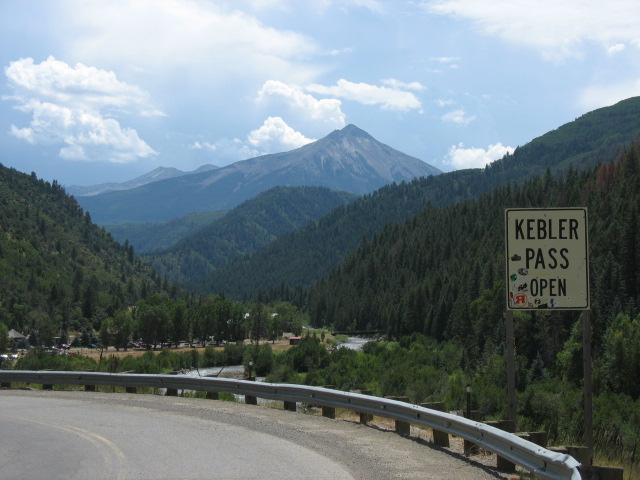
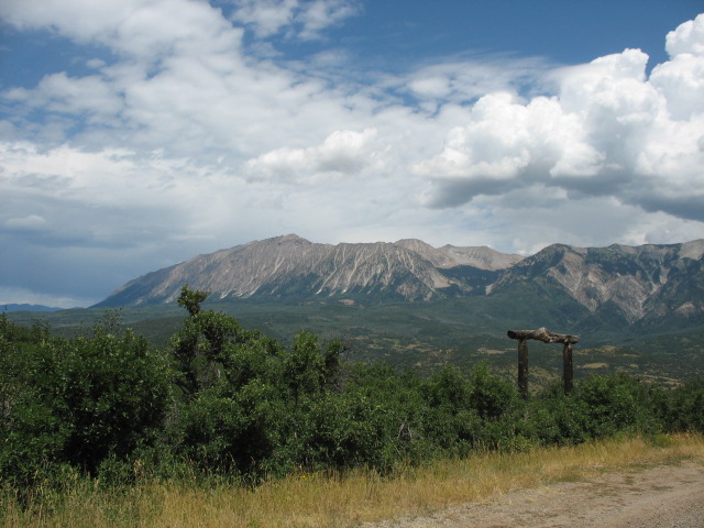
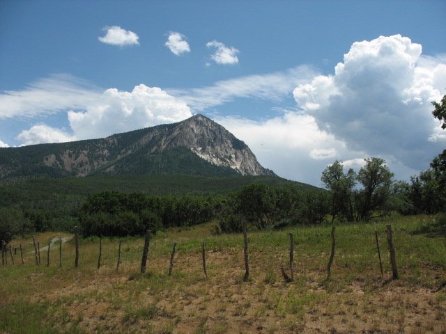
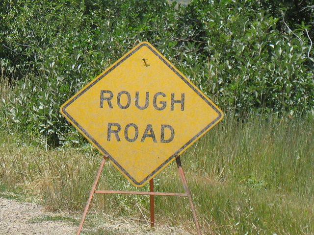
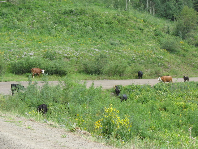
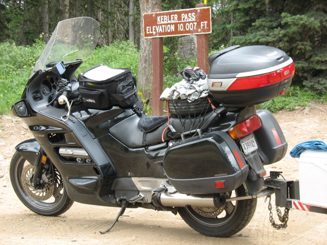
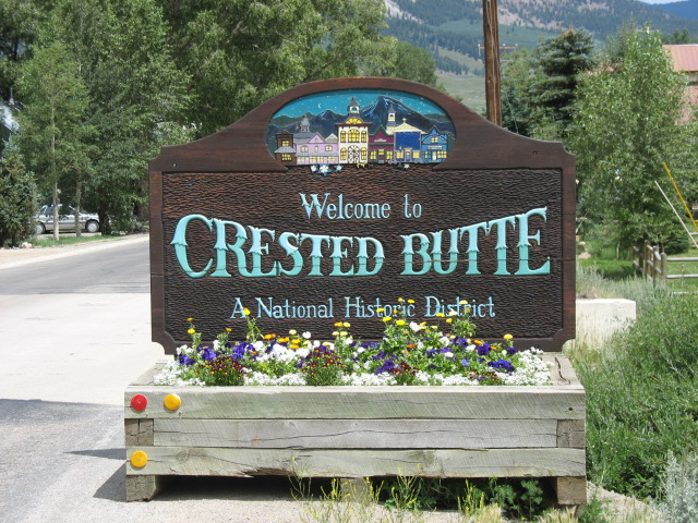
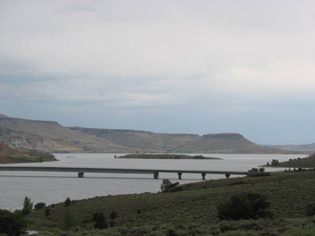
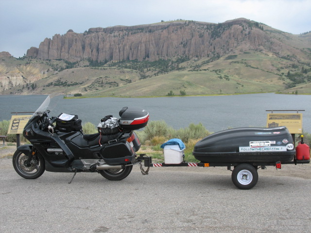
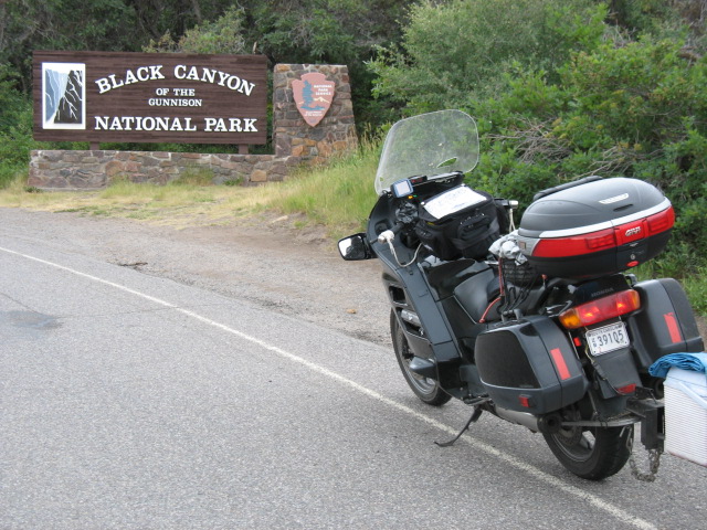
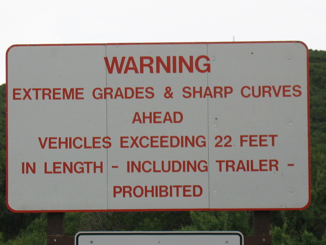
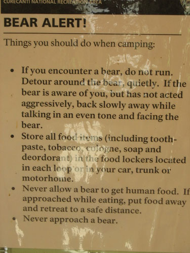
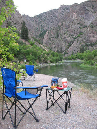
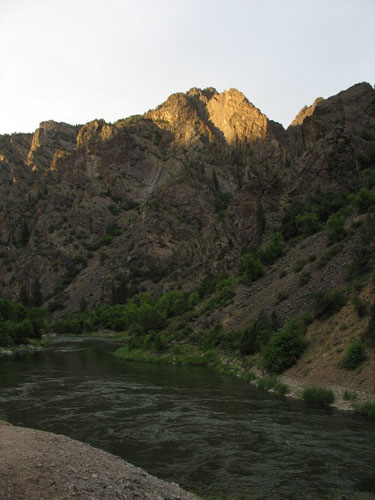
DAY TWENTY-FOUR COMMENTARY That? Oh, that’s just the sound of the Gunnison River roaring through the Black Canyon, two hundred feet away (and fifty feet below) my tent. Rewind, please -- let’s get out of Glenwood Springs first! Departure from the hostel was only so-so; the move to the dorm-style room had left me somewhat disorganized, and therefore running back and forth between the it and the trailer out front. Truth is I was still on the premises past check-out time, but not by much, and it didn’t upset Clarisa, manager on duty. It was also good because I was able to say “sayonara” to a few of the nicer folks who either worked or sort of lived there on a longer-term basis. Conversations the night before with John, the well-traveled manager for the evening, confirmed that my desired use of the “Kebler Pass” to the town of Crested Butte would not be too much for the rig to handle, and was a nicely direct route as well. Whether or not a particular pass was, um, “passable” was in no way a trivial matter: in a state where some mountain roads are only open for two or three months of the year, signs all along the way out of Glenwood indicated things like “Independence Pass Open”, “passage unlawful without proper equipment”, and the like. The first pass I needed to take, McClure Pass, was fully paved and reached an elevation of only some 9,000 feet; perhaps to show how little of a test that such a profile offered, there was apparently a bicycle race going on in the other direction. Reaching the start of Kebler Pass -- which, BTW, rendered the above map inaccurate, because I could force neither MapQuest nor Yahoo Maps to understand that the road was actually open -- I had a conversation with an amiable retired police officer who gave me some details on the route I was about to encounter. It was gravel, but it was also usually graded around the time it opens for the season, so for the most part it was not a loose surface. It was perhaps a little tricky when wet, but the sky looked to be clear of rain clouds, and at any rate I was now committed to going up there regardless, so off I went. After climbing rather sharply about two miles in, the road offered gorgeous views in all directions as promised. I was passed by, and then later (twice) caught up with two friendly gents riding their motorcycles from Dallas on a two-week jaunt around the Midwest. While I didn’t love the sign I soon saw, in truth the road was rather tricky already. Although the gravel had indeed been pressed down for the most part, the physics of rolling tires pushing towards the outsides of the curves served to form the gravel into ridges on the surface. As they seem to catch a motorcycle’s front tire at just the wrong moment and rob one of the precise steering control one would like, this is bad enough on a flat, straight road, let alone a twisting, climbing one. Then it started to rain. Not hard, but enough to fully dampen the road even through the beautiful and lengthy thicket of aspen trees it passed through. The cows didn’t seem to care, but I did, because now the road surface became that much trickier. Were I to catch a ridge, I’d have to be very careful about how forcefully I’d try to correct the new, unplanned route -- if I fed too much directional change to the front tire, it might slide once it bounced down off of a ridge, and put me right down to the ground. Almost certainly damaging the hitch apparatus beyond on-site repair, let alone possibly causing injury, in doing so. Ah, the nuances of motorcycling. But what could I do? I wasn’t going to go back -- not that that would have gotten me away from the ridges at any rate -- and there wasn’t really any room to pull over and stop, not that I wanted to sit there until (‘if”?) it stopped. So I pressed on, in extremely gentle fashion, and white-knuckled it in a few places where the road turned more quickly than I thought it would and where, naturally, the ridges were worse than I expected. Mercifully the rain stopped after the crest -- and right after I got back to pavement, of course --and I entered the town of Crested Butte. Now, people, I know this is starting to sound like a broken record, but here’s the deal: the historic downtown section of town was so inviting, I knew that if I got off that bike to take even one (1) picture, I’d be off the bike for several hours. As I did not have several hours to give, I therefore did not get off the bike at Crested Butte. Well, except to get gas, some white spray paint (for reasons which will be explained in due time), and some very expensive beef jerky (“Ray’s”, a local brand which was very good, and perhaps the second best I’d ever had behind Angelo’s up in Sonoma County, CA.) For the remainder of my riding day there were constant threats of rain, but little in the way of follow-through. There was an informative (and opportune) state park and rest stop at the foot of the Blue Mesa Reservoir (and/or Lake), the largest lake in the state of Colorado. Here I used the rest room; got a good estimate of remaining travel time; thrilled to the fact that it chose to drizzle only once I got inside, then stopped when I again emerged; and polished off a Red Bull to counter a sudden bout of drowsiness. Shortly thereafter a bridge crossed the lake and the formation known as Dillon's Pinnacles loomed above the other side. The nearby town of Sapinero consisted of little more than cute little homes hugging the hillside and offering their occupants a beautiful view of the lake and the Pinnacles. I arrived at Black Canyon of the Gunnison National Park shortly afterwards. Now, my original plan -- before I audibled the second day in Glenwood Springs -- was to hike down into the canyon and camp for two consecutive overnights down at one of the undeveloped sites closest to the river. As this hike would take a minimum of three hours, in addition to camp set-up, I would no longer be doing it now that I only had one overnight to work with. Not only that, the Park Ranger at the entrance said it was probably getting to be too late for just a round-trip hike even without the camping angle. She said I could choose to stay at the South Rim Campground up here, or at the riverside campsites down at the end of the East Portal Road. That road was too extreme for cars with trailers, which in fact were banned, but as the length of my rig was only 16 feet I could legally choose to take the whole thing down there. The Ranger also suggested that I could drop the trailer at the upper rim campground and scoot down for a visit with just the bike, if I was concerned about the braking power necessary to safely negotiate the road. Well, I gave the upper campground a quick check and wasn’t thrilled with what I saw -- nice enough and fully-equipped, but offering no views of the canyon from there, disappointing compared to what I had originally wished to do. I was about to start riding around on the rim to visit the overlooks when I thought, seriously, I can just use engine braking to make it down the East Portal Road in one piece, end up camping overnight by the river just like I wanted to, and check out the rest of the rim overlooks tomorrow morning when perhaps it would be nicer weather anyway. The road’s 16% downgrade was definitely a little hair-raising, as even in first gear the bike was pulled to speeds up to about 40 MPH on the longest straightaways. I feathered the brakes only when absolutely necessary and, while they were just a bit on the spongy side once I reached the bottom (1,800 feet below), there was never any real danger. Although it was made clear that we were definitely now in bear country, the decision to come down to the river was a winner, as this picture of my dining room for the evening will indicate -- are you kidding me, or what? So not only did I decide to prepare my favorite of the dinner selections I had brought along -- the chicken & rice -- but I figured it would also be OK to use the last of the Lipton Iced Tea mix to wash it down. (The one-match stove lighting affair, easily the cleanest since back on Day One, was icing on the cake.) After the meal was finished, out of nowhere I was offered a drink of Grand Marnier by two extremely friendly folks named Vicki and Alain, perhaps in return for my offer of the use of my sponge to help clean their pans of the cooking residue -- of the two trout that Alain had caught in the river just a little earlier! People, I certainly wished to take them up on their offer, but I felt very guilty about not having anything to make available in return, so I ran back to the trailer and fetched the Crown Royal Cask No. 16! I figured that the link to France (aged in cognac barrels) might be of passing interest to Alain, his having been born in Paris. Now, exactly how a city boy, such as he was, would subsequently become such an accomplished angler was never made clear, but the three of us spent a very enjoyable evening chatting about life, travel, coincidence, meeting people, and Airstream camper trailers. Shortly before the party broke up, the sun came shining through the clouds, illuminating the tops of the peaks opposite our site of the river. When it came time to retire, the climate was perfect for sleeping, and because I had thoroughly read the National Park Service's “Getting Used to the Darkness” handout, I wasn’t even scared over how dark it was down there once all the lights were out! |
|
|