| Day 25 (Aug. 5th): BLACK CANYON NATIONAL PARK, CO to BLUFF, UT | 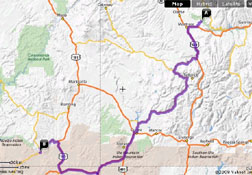 |
| <- PREVIOUS DAY | Predicted Dist. & Time: 285 mi. / 6:00 - Actual Dist. / Drive / Total Time: 249.3 mi. / 5:03 / 6:29 | NEXT DAY -> | |
|
Click n' Return:
|
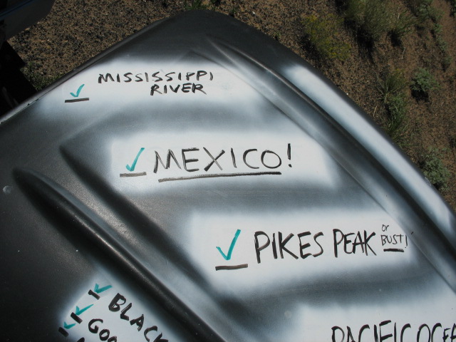
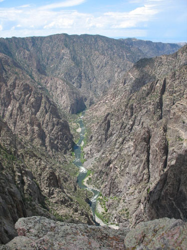
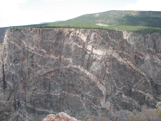
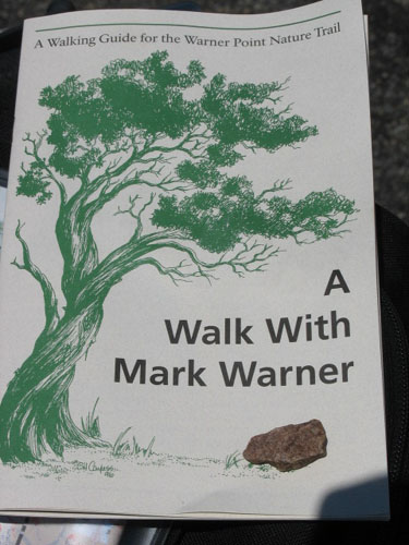
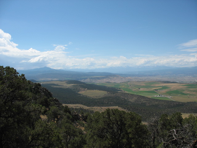
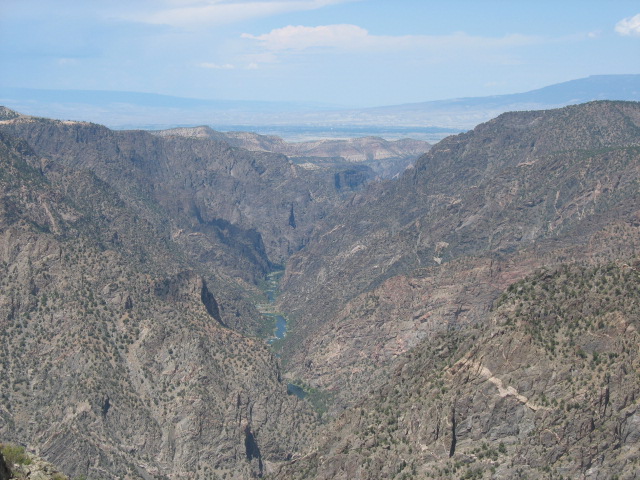
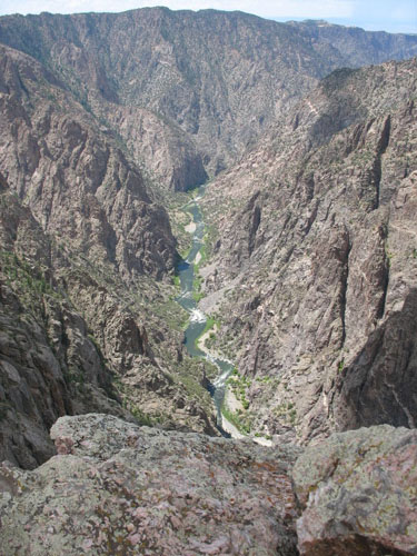
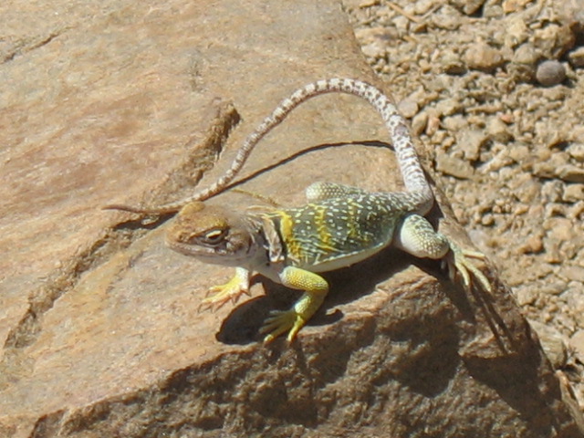
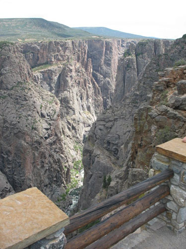
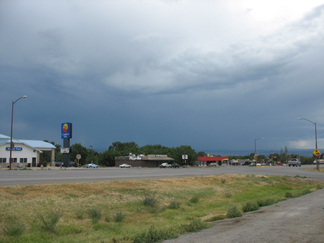
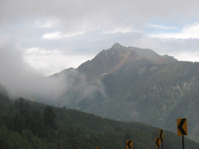
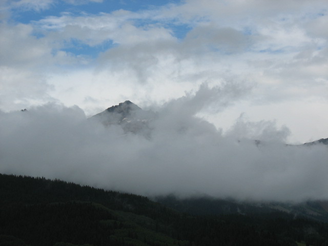
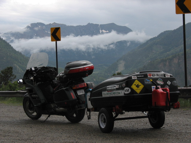
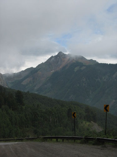
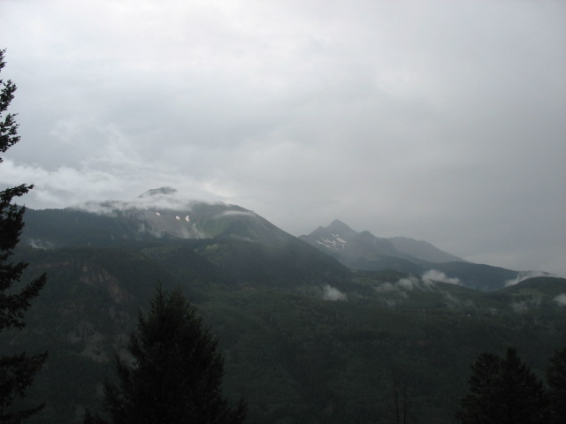
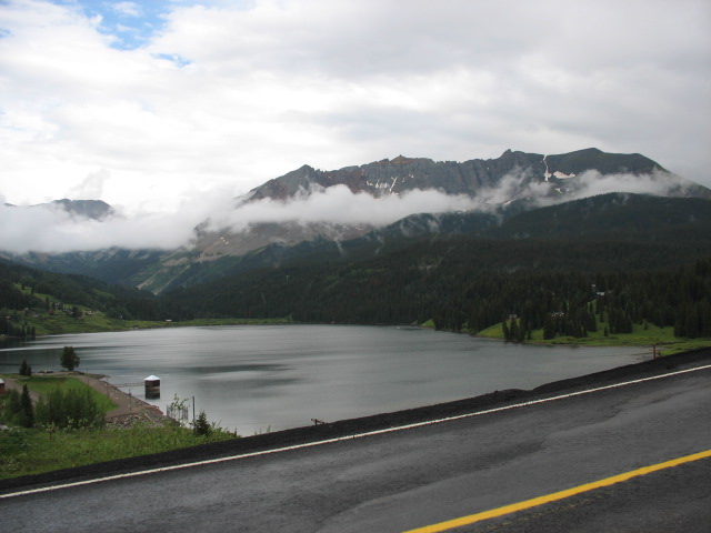
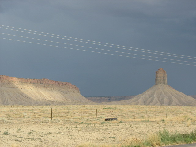
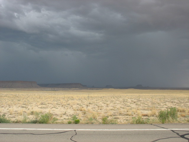
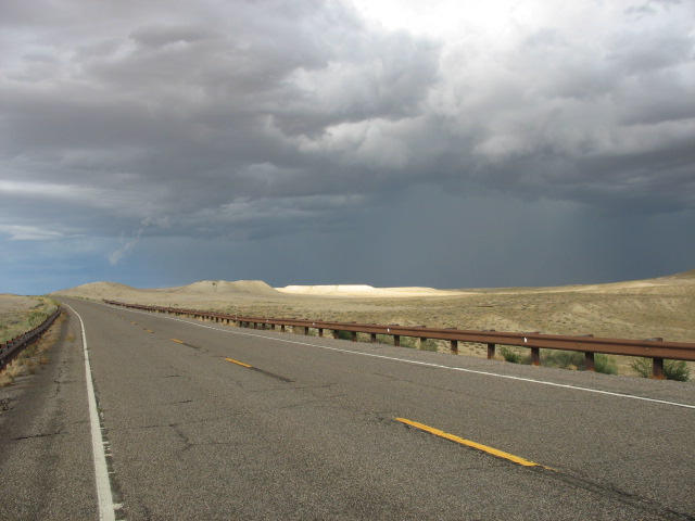
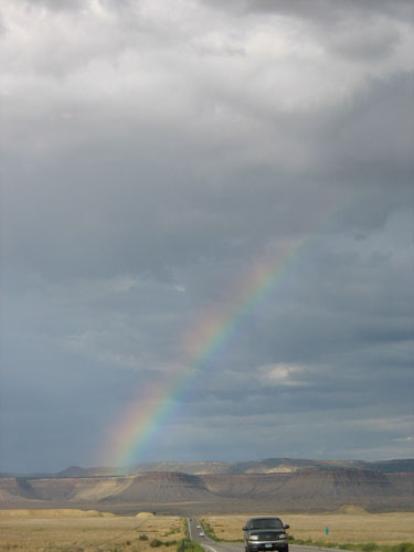
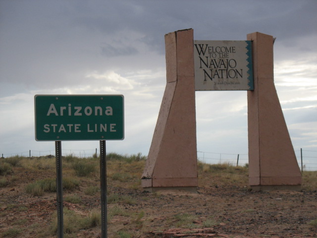
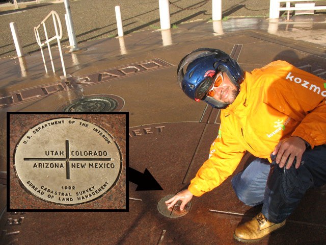
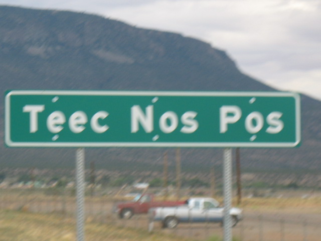
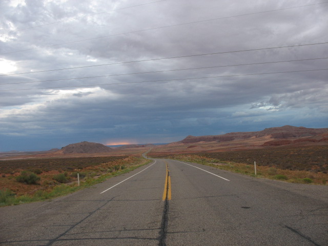
DAY TWENTY-FIVE COMMENTARY You know, it occurred to me that -- after entering the line-up in place of the old jeans with the new holes in them -- what I had been thinking of as the “Dress Jeans” have really been in the line of fire! (Who cares -- Ed.) Departure from my campsite at the bottom of the Black Canyon was on the slow side, partly because it included breakfast, a re-packing of the clothing bag (to bring the more oft-used items closer to the side where the trailer lid opens), and the “project” for which I had purchased the white spray paint back in Crested Butte. This was a quick, stupid idea to make up for the paucity of bumper stickers in certain locations -- paint white boxes onto the trailer, write in the names of the more prominent stops that failed to offer a sticker, and make it like a little "checklist" as it goes along. Well, it came out great the very first time I painted them on, but then I realized I had written in the words facing the wrong direction. It therefore had to be re-done, and I had to wait for the paint to dry before I took off, lest it become encrusted with road grime. Not to mention that the box "edges" came out nowhere near as sharp the second time as they had the first. Sigh... The climb back up the East Portal Road went without incident, and at its end I turned right to explore the South Rim of the canyon. The vistas offered at several of the pullouts were exceptionally impressive, and as hoped, the weather was nicer than the day before. To reach Warner Point (where the rim is at its highest above the river, 2,700 ft. down), there was a 0.75 mile hike, which to save time on I decided to jog in places it was safe to do so. A couple coming in the other direction told me that “it [the Point] will still be there if you walk instead”, and we laughed and I thanked them for the tip. I kept going anyway, and what happened was that, while I wasn’t necessarily tired nor thirsty, my mouth became very dry, very quickly. I decided there was no better time to try out a trick I had read about some thirty-five years ago -- in an event which had occurred some sixty-five years ago -- but had never had the opportunity to use. At her house in Hampton Bays, NY, my grandmother had a fantastic, great big book about World War II. When I was younger I found the pictures of the various planes and vehicles to be interesting, and as I got older I was naturally interested in the historical content as well. At some point in the book, there was a section regarding some of the brutal prisoner marches that the Japanese Army had forced captured GI’s to undertake. I had always remembered one survivor’s account of how, under such duress, he had helped to keep his mouth and throat from becoming parched; as he told it, had any of the Japanese known he had done it, he probably would have been in even more trouble. All he did was to employ what he called the “farmboy trick” of placing a pebble in his mouth, thus fooling his salivary glands into thinking he was eating, and turning on the waterworks. Sixty-five years after he did it, and thirty-five years after I read about it, I finally got to try it: I picked out a pebble, tried to clean it off as best I could, and popped it in there. Now, people, I’m not going to tell you that it’s the same as taking a few swigs from a water bottle, but for the purpose of addressing a dry mouth, it works like a charm. (Just don’t try to eat it!) The view from Warner Point to the east was of the river and the Canyon; to the west the land flattened out and supported farming and ranching. I noticed a lizard basking on a rock, and managed not to scare it away; I stuck around when a fly landed on the same rock, and set the camera to "film" mode, hoping to possibly catch the sight of my new friend snagging a meal with a flick of the tongue. Such was not to occur, so I hiked back to the bike and visited several of the other scenic overlooks as well. At one of the stops I happened upon a young Park Rangerette carrying a tub of historically important items -- pelts, spearheads, examples of rock art, etc. She said that researchers were able to determine which periodic bracket the Indian the art hailed from, not because of the depth in the canyon at which they were located -- as little, if any such evidence had ever been found down at the bottom -- but because of the development of the human image itself, and then the eventual appearance of horses within the painted scenes, and so on. The length of the neck of a spearhead was also a clue to its age, as the trend was for these to be made longer with the later societies. At the visitor center I snagged yet another excellent and informative National Park pamphlet, in which it was explained how the erosion cycle of the Black Canyon (fast rushing water through hard rock) had differed from that of the Grand Canyon (slow rushing water through softer rock) and Yosemite (glacial carving after an uplift). It also noted that the tops of the south rim here (facing north, therefore receiving less direct sunlight, and therefore not drying out the moisture as quickly) had eroded faster and taken on a more angular profile up towards the top than had the north (“south-facing”) rim. This explanation, I now recalled, would hold for the cliff tops back along the I-70 Corridor into Glenwood Springs as well, as the north rim was often noticeably more sheer than the south. My sightseeing at this magnificent park sadly done with, I headed towards the town of Montrose, fell for the ol’ “First Gas Station in Town” trick, and paid $3.999 a gallon. Just a bit more patience could have saved me seventeen cents a few miles further on. Once again, the “original” town center displayed it’s a functional personality and style, which after a left-hand turn soon yielded to the inevitable “mall-ification” and “chain-ification” on the way out. I tried to figure it out: who really needs it? Like, if the town grows a bit too big for the old center to handle, does adding all of that generic garbage really make it better, or more liveable? (The same thing was to be true with both the towns of Dolores and Cortez later along the way -- cool, “authentic” older stuff, bogus contemporary crap.) Not long after leaving Montrose I passed by the headquarters of “Ray’s Jerky”! Though I didn’t need any more of the stuff, I was tempted by the fact that I probably would have paid about a dollar a bag there, rather than the $6.99 I had been nicked for back in Crested Butte…OUCH… Now, back in Montrose I had donned the rain gear, as nasty-looking clouds threatened in the distance, and it had been pretty clear that my path would pass right under them. Well, right after passing through Ridgway (ho-hum, yet another very cool little historic-looking town), we finally got rain, for real, for the first time since Day Two. A constant rain, and fog in some parts, on Rte. 145 towards Telluride. The two-lane road was narrow, twisty, and somewhat busy, but it did feature a consistently good surface so it was manageable. For just a brief moment I was able to spot a fast-moving, muddy river as it merged with a much clearer one, but then it was past and I had to focus on traffic again. I never actually went through Telluride, as the road branched off about one mile before it. Although carrying the same route designation, the segment immediately after the turn-off was much worse, as it was inexplicably rutted despite apparently having been resurfaced not long ago. Mixed in with the rain and fog, this presented some more nervous moments in the steep twisties... As the clouds passed below me through Sunshine Pass (!), there were some good, if brief views of the valley and of Mount Wilson and Sunshine Mountain. After passing Sheep Mountain (known locally as the “Matterhorn”) and Trout Lake, the road itself improved, but the precipitation became even worse. There were times when I could see a line in the road ahead, which was where the intensity of the downpour had somehow strengthened, even though it was already coming down more than hard enough, thank you very little. Through these segments I could barely see the road for all the raindrops hitting it, and I took to playing an extremely delicate game of high-stakes risk: pull over, stop, and stand still in the monsoon, OR follow a tractor-trailer in front of me closely enough such that I could ride in its tires’ “wake” through the quarter-inch of literally flowing water, yet not so closely as to catch the spray and airflow disruption coming from the trailer. Which cherce do you think was made by The Chief (tm)? FWIW the periodic (and unavoidable) mud washes across the pavement were a real hoot as well. Mercifully, for all the chaos going on outside of it, my rain gear was keeping me perfectly dry inside of it. As the rain began to let up, the rig hit the 5,000 mile mark in Rico, CO -- three blocks long and, um, one block wide. The town still featured an old locomotive filling station (for coal? For water?), and the “Rico Hotel & Restaurant”. The sign for the Argentine Grill promised “Fantastic Food” -- and if the aromas wafting through the air were any indication, they were telling the truth. I wish I could have stopped and stayed! As mentioned, Dolores was another cool little place (to wit, the Old Germany Restaurant -- “With Beer Garden”). Again, I wish I could have stopped and stayed! Ditto Cortez, and then past a casino on the outskirts, I was back out into the boonies. Here there were mesas and rock formations, huge storm clouds in the distance, lightning. As I turned east towards Four Corners, the sun poked through the clouds in spots here and there, highlighting haunting -- yet also beautiful -- scenes. Then the rain began to fall at a 45-degree angle onto the otherwise sunlit road. It was very windy and wet, though still sunny and warm, at the Four Corners National Monument, all of it on Navajo Nation. I minimized the clowning but still relished the ability to be in four states at once. The wind tried to blow me across the road for the next dozen miles, but at Teec Nos Pos* I turned right again, and for at least a little while it was directed much more at my back. (* The settlement of Teec Nos Pos is the place nearest to the Four Corners that the various mapping websites are able to recognize. During the investigation of possible travel itineraries, I must have typed that oddly-lettered name dozens of times, so I figured it had earned its spot on this page. For all that, I am bummed that the pic came out blurry, but I couldn’t tell that at the time I snapped it. -- Ed.) Needing to re-fuel, I was relieved to see it offered at the Red Mesa Trading Post for just $3.999 -- though I also wondered why it was so cheap here, when thirty miles earlier it was comfortably above the four-dollar mark? There was nothing around for dozens of miles, so I figured they could have done what they wished. Then I found out that the Navajo businesses are not required to collect certain Federal taxes, which obviously helps keep the prices down. The folks I met inside were very friendly, and helped suggest the easiest route to my hoped-for destination, Goosenecks State Park near the settlement of Mexican Hat, UT. Although I didn’t know it at the time, a later check of the map revealed that I had also passed through the “settlement” of Mexican Water, AZ -- though the only thing I had actually seen in the area was a sign for a church. There were still more beautiful and/or scary views on the road north into UT, and it was definitely getting dark, and I still had about 45 miles to go. Big black clouds sat tightly on the horizon, sending lightning bolts to the ground with intimidating regularity. I was no longer so sure I wanted to pitch a tent, in the dark, in an electrical storm, at a state park with completely undeveloped campsites, so I audibled and veered eastward to Bluff, UT. At one time I had considered overnighting there anyway, so I knew where the local inns were located. Alas, I found no joy at the first of them, nor at the second, nor at the third. Literally in the process of turning back around and pitching the tent under a bridge I had spied (across a dry wash), the headlights suddenly illuminated the entrance to the Cadillac Ranch RV Park & Campground. I considered myself very lucky to have snagged a tent site at this fully-equipped facility for just $17! |
|
|
|
|
|||